- Printed on Polypropylene (plastic)
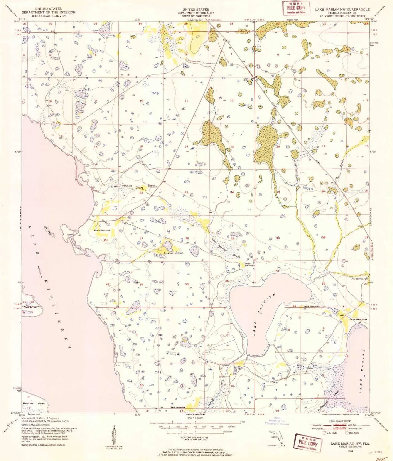
- USGS topographic map of Lake Marian NW, FL, at 1:24000 scale. Heavier material. Waterproof. Tear-resistant. Foldable. Perfect for the outdoors.
- Cities, towns, villages: Please see map preview to find populated places, townships, as well as roads and street names if available.
- Islands: Parker Hammocks,Sawgrass Hammock,Orange Hammock,Jack Hammock,Camp Hammock,Sailor Hammock,Kettle Hammock,Bird Island
- Parks and forests: National Parks, National Forests, etc. Please preview map image for specifics.
USGS topographic map of Lake Marian NW, Florida, dated 1953, updated 1954.
Includes geographic coordinates (latitude and longitude), lines of elevation, bodies of water, roads, and more. This topo quad is suitable for recreational, outdoor uses, office applications, or wall map framing.
Printed on-demand by YellowMaps on the print material of your choice.
Shipping rolled from Minneapolis, MN, United States.
Product Number: USGS-5625622
Map Size: 26.7 inches high x 22.9 inches wide
Map Scale: 1:24000
Map Type: POD USGS Topographic Map
Map Series: HTMC
Map Version: Historical
Cell ID: 24526
Scan ID: 347062
Imprint Year: 1954
Woodland Tint: Yes
Aerial Photo Year: 1950
Field Check Year: 1953
Survey Year: 1951
Datum: NAD27
Map Projection: Polyconic
Map published by United States Geological Survey
Map published by United States Army Corps of Engineers
Map Language: English
Scanner Resolution: 600 dpi
Map Cell Name: Lake Marian NW
Grid size: 7.5 X 7.5 Minute
Date on map: 1953
Geographical region: Florida, United States
Northern map edge Latitude: 28°
Southern map edge Latitude: 27.875°
Western map edge Longitude: -81.25°
Eastern map edge Longitude: -81.125°
Surrounding map sheets (copy & paste the Product No. in the search bar):
North: USGS-5624984,USGS-5624986,USGS-5624982
East: USGS-5625620,USGS-5625612,USGS-5625614,USGS-5625618,USGS-5625616
South: USGS-5625642,USGS-5625638,USGS-5625640
West: USGS-5625762,USGS-5625760,USGS-5625764,USGS-5625758


